Historic Sea Port and Fishing Port
Bluff was not a settlement until the arrival of Europeans but the area surrounding served a variety of functions for the Māori before European settlement. The main Māori settlement in the area which became known as Southland, was Ruapuke Island, which with its seven pa was the base of the paramount chief of the South Island, Tuhawaiki, otherwise known as ‘King of the Bluff’ or ‘Bloody Jack’. Smaller Māori settlements were scattered along the Southland coast, including villages at Ocean Beach, Ōmāui and Oue on what is now known as the New River Estuary.
The European arrived in Bluff sooner than in many other parts of New Zealand. The first record of a boat entering Bluff Harbour was in 1813 when a Sydney expedition, on board the ‘Perseverance’, was sent to report on the possibilities of trading in flax.
The first European to settle at Bluff was James Spencer, a veteran of Waterloo. He arrived in 1823, aboard the ‘St Michael’. He left to return the following year and established a permanent home. Spencers settlement was one of the earliest in New Zealand – the first to survive to become a town. Bluff therefore has a longer history than any other town in New Zealand.
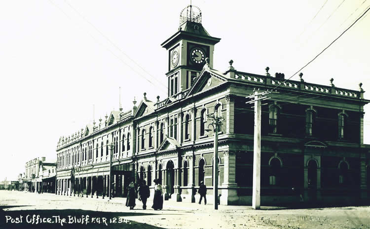
In 1856 the town was surveyed by JT Thomson, who called it Bluff Town and named the streets after rivers in Ireland. That did not meet instant approval for he was ordered by the Superintendent of the Province, Captain Cargill, to change the name of the town’s main street from Shannon to Gore street, to honour Governor Gore Brown, and to rename the town Campbelltown to honour the Governor’s wife who was a Campbell. The Governors word was law and the town was officially known as Campbelltown until March 1917 when the name of Bluff was officially adopted.
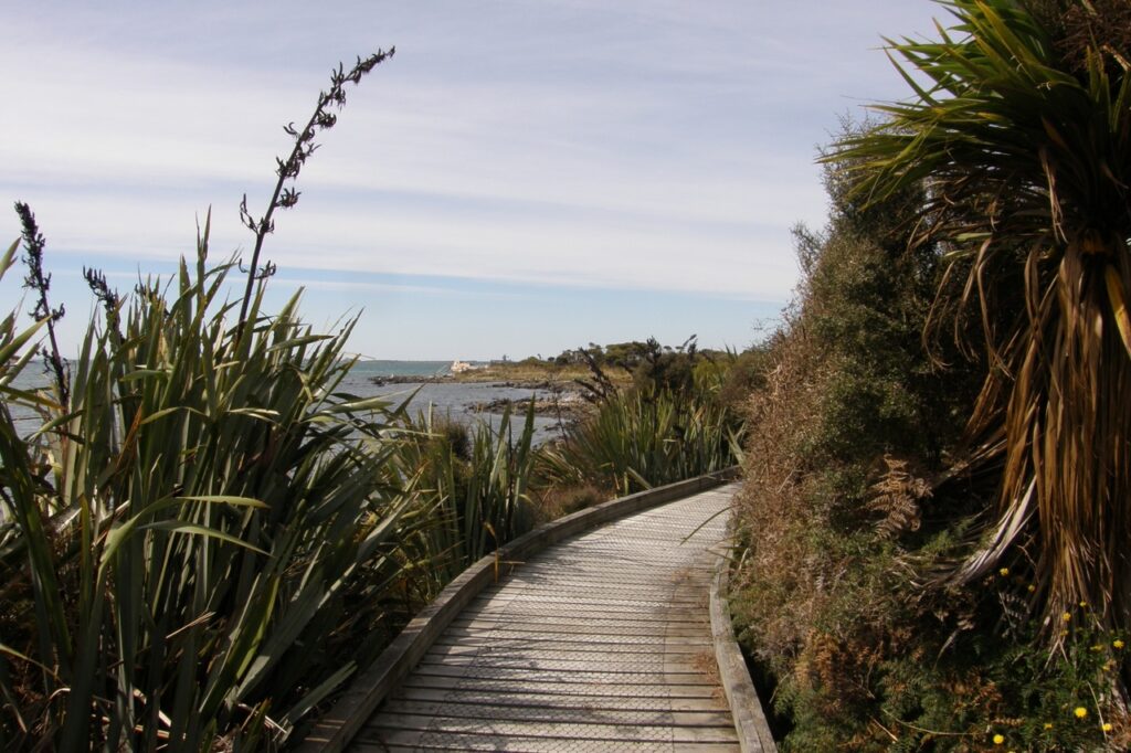
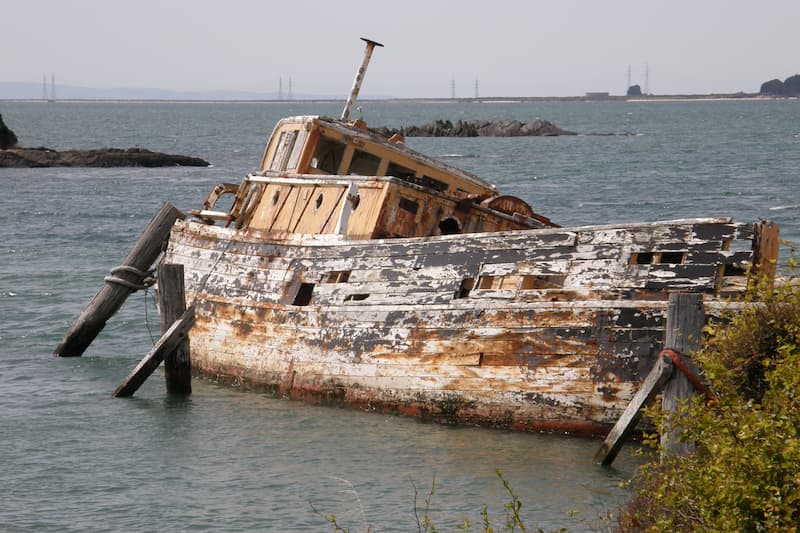
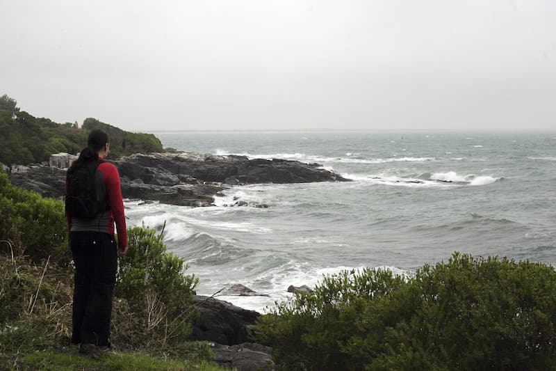
Bluff township has a lot of notable historical sites to be seen, Whalers point on the Foveaux Walk, remains of the shipwreck ‘Konini’ also on the Foveaux Walk, the old cemetery at the end of Lagan St, to name a few.
Bluff Heritage Trail
The Bluff History Group’s Heritage Trail is another fantastic attraction.
Featuring seventeen sites, the trail begins at the Greenhills Church and takes you to a variety of sites including the Greenpoint Walkway, the Monica, several buildings and homes of historic interest, the old Bluff Cemetery and Stirling Point to name just a few.
A good place to find further information and directions on Bluff’s landmarks is here or at the Bluff Maritime Museum who are one of many stockists of the Heritage Trail brochure.
Even if you do not have time to follow the trail take a look at the brochure as you may find something of interest that you can visit individually.
Bluff Maritime Museum
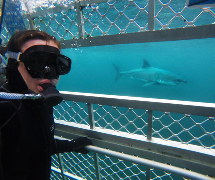
A “must visit” with fascinating historical information about the many early shipwrecks in these challenging southern waters and coastlines. You will be able to visit many of these sites as you make your way along the Catlins Coast towards Dunedin.
While the museum has a maritime theme with displays on whaling, oystering, shipwrecks , and the construction of the adjacent Island Harbour, it also delves into the history of Bluff.
Being the oldest continuously European settled community in New Zealand there is some fascinating history on offer! The museum also exhibits artwork showing scenes of Bluffs early days when it was officially known as Campbelltown. Early maps also depict that Bluff was always going to be an ideal place to become a port to shelter ships and boats, from the elements of Foveaux Strait.
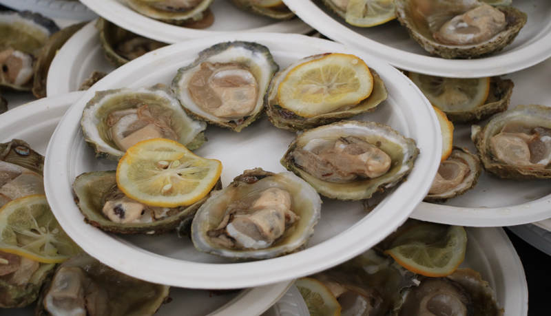
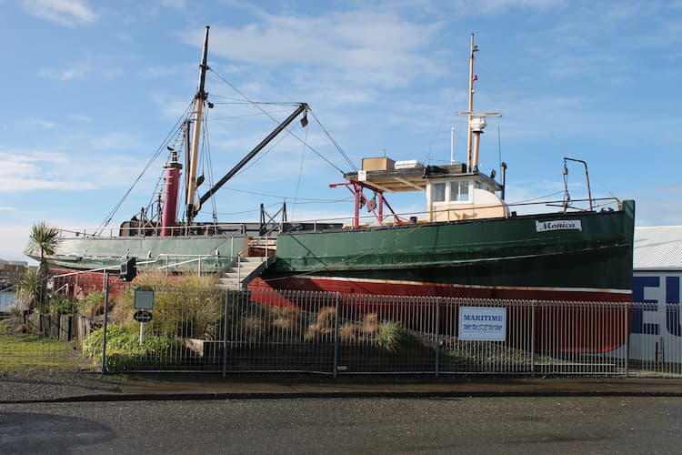
The Museums biggest attraction is the oystering boat the Monica. The boat kindly donated by the Jones family is a permanent fixture beside the museum. You are able to board the vessel and explore all its nooks and crannies and imagine what it was like out in Foveaux Strait dredging Bluffs delicacy.
An historic vessel she was one of the oldest in the Bluff Oyster fleet, being built in 1909 for Lyttelton owners as the Monica II, one of many small steamers working the bays of Banks Peninsula. She was converted into a fishing boat in 1930 when bought by Westport interests, then came to Bluff in 1937 for Stewart Island canneries.
In December 1947 her steam engines were removed and two diesels, each 165 bhp were installed. The Monica was an Oyster boat noted for its speed. On the opening day of the Oyster season she was always one of the first boats to bring the delicacy back to the wharf.
Today she lies high and dry next to the museum rigged as though oystering and fully accessible for all to view. The Monica is an asset to the Museum and a must to see.
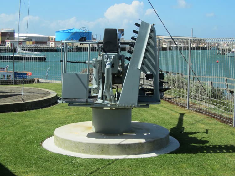
One of the former tug boat ‘Awarua II’s’ engines is now an operational interactive display at the museum.
With a continuously growing collection of exhibits and artifacts, there is always something new to see every time you come to Bluff at the Maritime Museum.
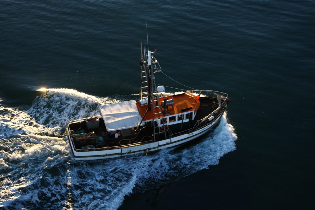
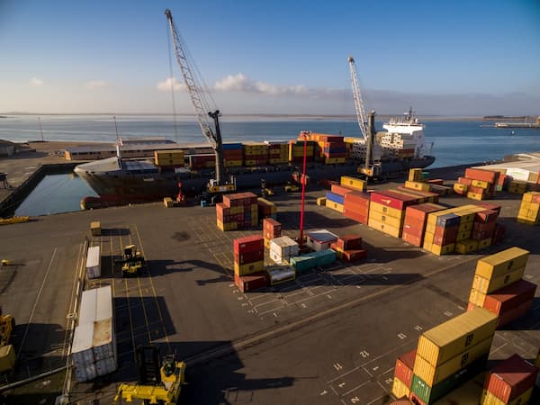
The Port of Bluff
Source: bluff.co.nz/port
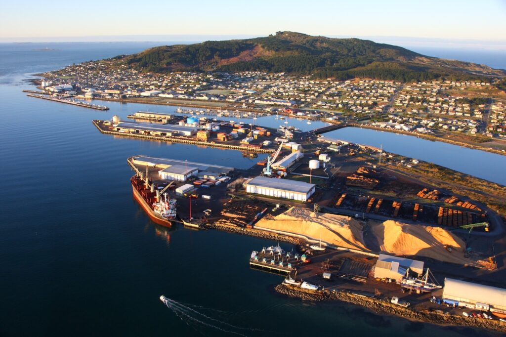
The Port of Bluff is operated by South Port New Zealand Limited, successors to the Southland Harbour Board. It is located on a natural harbour some 5.500 hectares in area overlooked by Bluff Hill, 264 metres high. Because of the island-like appearance of the hill from seaward, and the white convolvulus which still grows on it, local Māori called Bluff. Motu Pohue. Early European names were Port McQuarrie and Campbelltown, locals, however persisted in calling the town Bluff and the name was eventually officially recognised.
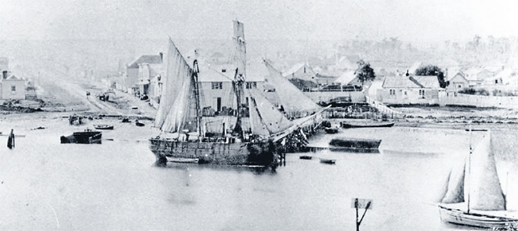
On 27 December 1822 the little sloop ‘Snapper’ became the first deep sea vessel to enter the port. She came in search of flax but was soon followed by whalers and sealers. James Spencer established a trading post in Bluff in 1824 to supply visiting ships, becoming Bluffs first European resident and as a result Bluff is now considered to be the oldest continuously occupied European settlement in New Zealand.
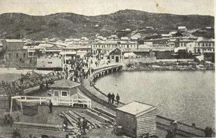
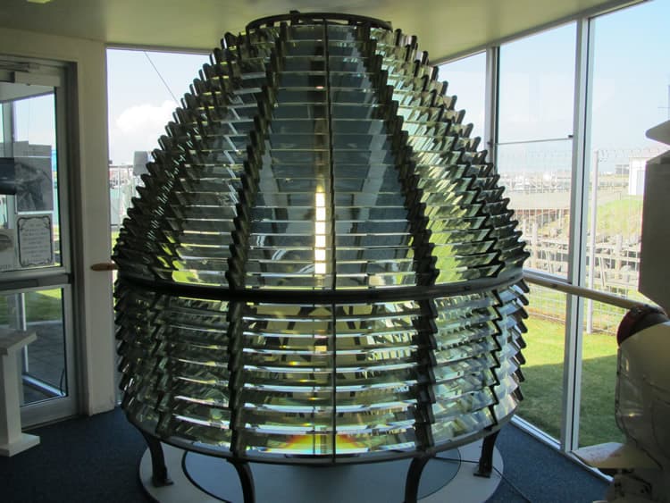
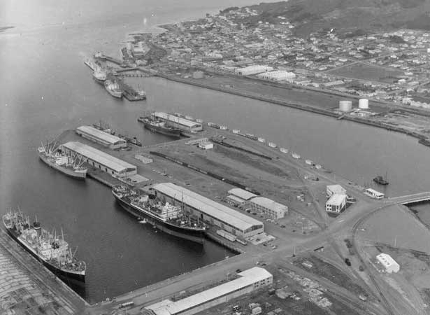
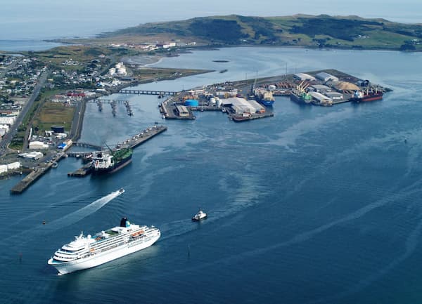
Captain Stirling later founded a whaling station near the point which now bears his name. This was to become the site of the port’s first pilotage service and traces of it may still be found in the small cove north of the Stirling Point lighthouse, itself a later addition dating from 1912. By then Bluff was a thriving port, construction of the Town Wharf having commenced in 1863. In the same year the railway to Invercargill was begun but due to financial constraints was not completed until 1867, thus failing to be the country’s first. Bluff’s now demolished railway station was once the world’s most southerly. A major expansion of port facilities in Bluff began in 1952 when the decision was made to reclaim an area of shallow sandbanks and proceed with construction of what is now the Island Harbour. Officially opened on 3 December 1960, reclamation continued until 1982 when number eight berth was completed. Facilities on the Island Harbour include tallow storage, grain silos, loader for wood chips and other bulk cargoes, extensive cool stores and a ‘Syncrolift ship-lift which, with a capacity of over 1,000 tonnes, is New Zealand’s biggest.
Dominating the eastern side of the harbour is Tiwai Point aluminium smelter, opened in 1971, which produces over a quarter of a million tones of aluminium each year. Tiwai wharf was built to service the smelter, the approach bridge to the wharf, at 1.2 kilometres, being one of New Zealand’s longest. The small derelict jetty nearby served the old quarantine station and hospital.
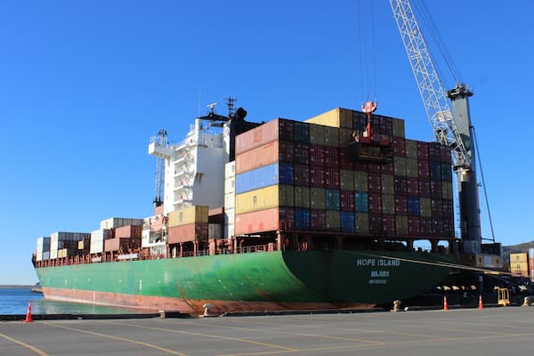
Annual cargo throughput at Bluff is about 1.7 million tones. Imports include alumina and other raw materials for the smelter, petroleum products, fertilizer and paper pulp while exports comprise aluminium, meat, wool, tallow, forest products ranging from logs to furniture, fish and grain. The largest ship, in terms of gross tonnage, to have entered Bluff is the wood chip carrier ‘Forest Way’ at 39,296 tons and vessels up to 260 metres long are handled regularly, Shipping movements are assisted by the port’s Voit-Schneider tugs ‘Monowai’ and Hauroko’ of 30 and 35 tonnes bollard pull respectively.
Events in History
Bluff Island Harbour opened
The 40-ha man-made Island Harbour, which took eight years to construct, is the centrepiece of the modern port facilities at Bluff, New Zealand’s southernmost commercial deepwater port.
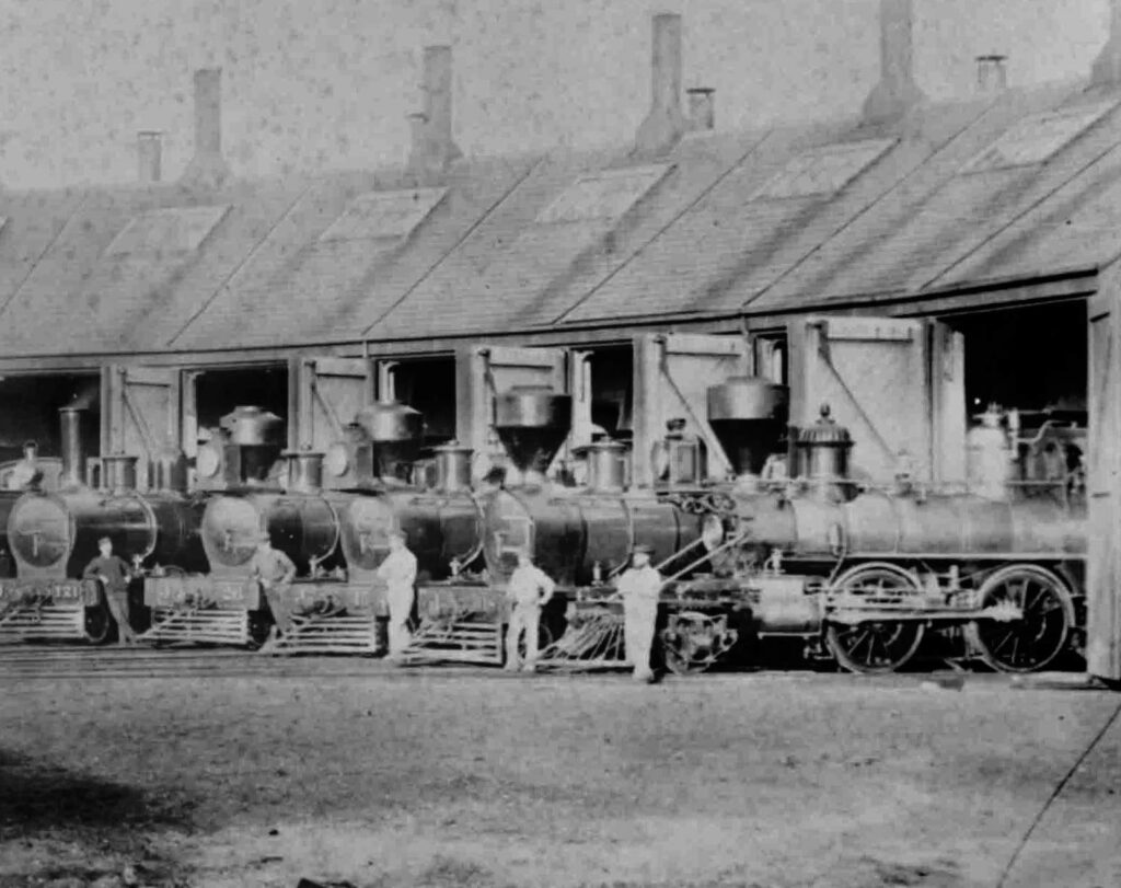
Opening of railway from Invercargill to Bluff
The 27-km line between Invercargill and the port at Bluff, built by the Southland Provincial Council, was the colony’s third public railway.